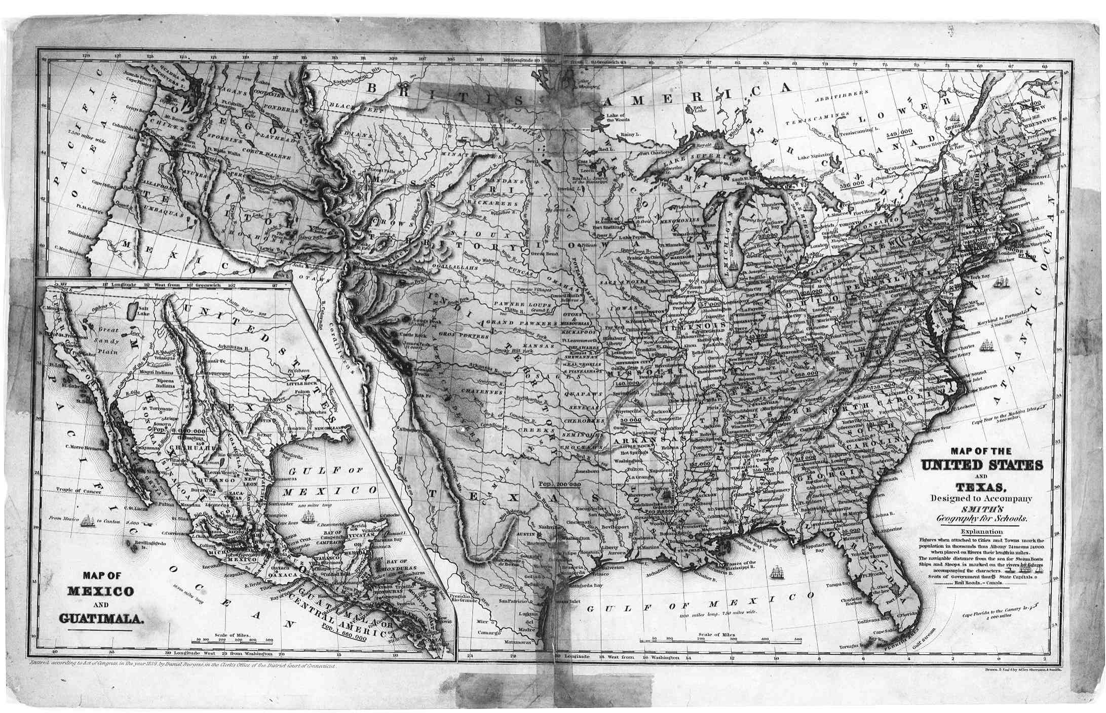
Sunday, April 5, 2015

Maps of North America as Knowledge

 With modern technology, such as the GPS people don't know how to read maps.  Maps are an important part of American culture.  With the interstate highway system people relied on maps to figure out how to get somewhere.  They used to maps to plan trips instead of getting on the computer.  The maps from AAA and Rand McNally have been the map of choice for many people.

Here is a good video about how to read a map.
http://video.about.com/geography/Read-a-Map.htm

The compass dude has good examples about how to read a map.  This will be good to know if you are out in the wilderness and get lost.  A map and compass will help you.  Here is how to read a map: http://www.compassdude.com/map-reading.shtml

Google earth and mapquest are also great tools to plan trips and find how to get from here to there.

Resources:

about.com. How to read a map.  Retrieved at: http://video.about.com/geography/Read-a-Map.htm

compass dude. How to read a map.  Retrieved at: http://www.compassdude.com/map-reading.shtml

Saturday, April 4, 2015

Maps of North America and copyrights


This is what the United States Digital Map Library says about copyrights.
"The Archives are intended for information that is in the Public Domain, i.e. that which is uncopyrightable, or the copyright has expired. The Digital Map Library will not knowingly place any file online that is under copyright, without permission of the copyright owner. In placing maps in the Archives, the following general guidelines have been used:
1.) ALL items with an ORIGINAL publishing or copyright date prior to 1923 are public domain. Anyone, including the United States Digital Map Library, may use them and distribute them freely.
2.) For items between 1923 and 1950, in order to still be copyrighted, the copyright holder must have renewed the copyright before the date it originally expired (a term of 28 years). However, because of the difficulty in determining the renewal of copyright for most documents of this period (as well as 1950 to present), it is required of the submitter to provide assurance of non-copyright for other than “public domain” materials."
The newer maps will be under copyright protection and should not be copied for commercial use.

Resources:
United States Digital Map Library. Accessed at: http://usgwarchives.net/maps/submissions.html

Maps of North America - Authors

John James Abert


John Mitchell is an important author of maps in 1755.  His map played an important role in american history.  Cartographers are map makers.  Here are some important ones in the US: Carlton Osgood, 1816, George Washington 1732 - 1799 and John Abert (United States 1788-1863) "headed the Corps of Topographical Engineers for 32 years and organized the mapping of the American West." J.H. Colton (United States, 1800-1893), Fielding Lucas, Jr. (c. 1781-1854) Lucas Brothers, Baltimore, USA where he made and published maps, Matthew Fontaine Maury (American 1806 - 1873), Thaddeus Mortimer Fowler (1842-1922) "American producer of pictorial maps", John Paul Goode (1862 - 1932) created the "Evil Mercator" and "Good's World Atlas", Rafael Palacios (1905-1993) "prolific map-drawer for major U.S. publishers and Waldo R. Tobler (1930 -) "developed the first law of geography" and also helped develop Geographic Information Systems or GIS.  This is just a few of many map makers throughout the past few centuries.  


Thaddeus Mortimer Fowler's pictorial map


 J.Q. Cummings founded Rockford Map Publishers in 1944 in his basement where he painstakingly researched, hand drawn and published his maps.


Resources:

Edney, M. H. (2007). A Publishing History of John Mitchell's Map of North America, 1755-1775. Cartographic Perspectives, (58), 4-27.

John James Albert. Accessed at: http://www.ask.com/wiki/John_James_Abert?qsrc=3044&lang=en

List of cartographers. Accessed at: http://www.ask.com/wiki/List_of_cartographers?lang=en

Pictorial maps. Accessed at: http://www.ask.com/wiki/Pictorial_maps?qsrc=3044&lang=en

Rockford Map Publishing. Accessed at: http://www.rockfordmap.com/About.

History of maps of North America in 20th and 21st Century - Publisher

The 1900's began the age of transportation and the automobile.  The United States had many maps for drivers on the open road.  The interstate highway system was born.  Rand McNally first published "The official Transportation Mileage Guide" in 1936.  They were founded in 1856.  In 1904 Rand McNally's published its first automobile road map for New York City & Vicinity.  On April 15, 1924, Rand McNally published its precursor to the best-selling Rand McNally Road Atlas called "the Rand McNally Auto Chum."  In 1960, "the first full-color Rand McNally Road Atlas premieres."  In 2009, Rand McNally launched a GPS for truckers and in 2011 they launched a GPS for RVers.  In 2013 Rand McNally printed its 90th edition Road Atlas and also launched an iPad app and eBook version.  A lot has changed since they first started making maps.  They have a place online to plan your trips called Tripmaker.

Map of Chicago from the 2015 Rand McNally Road Atlas.


Here is a list of 15 publishers of maps besides Rand Mcnally.  They are: The National Geographic Society, Sunbelt Publications, Inc., Bilingual Books, PennWell Books, Japan Pacific Publications, Inc., American Map Corporation, Hammond World Atlas Corporation, Berkshires Week, Peninsula Clarion, North Seattle Herald Outlook, Sonoma Valley Sun, Planet North Shore, Billerica News, St. Johns Independent, mapsales.com.  There is also Rockford Map Publishers.  They are at;http://www.rockfordmap.com/About.

Resources:

http://www.publishersglobal.com/directory/united-states/media/map-publishers/1/ 

http://www.randmcnally.com/about

http://www.randmcnally.com/about/history

Rockford Map Publishing. Accessed at: http://www.rockfordmap.com/About.

History of maps of North America in the 18th and 19th Century


This is North America in the world atlas by Guillaume Delisle in 1700.


Halifax commissioned John Mitchell to create a large map in 1755.  His map showed the Great Lakes to the Gulf of Mexico and the Appalachian Mountains to the Mississippi River.  John Mitchell's map was published in London.  "Lawrence Martin (1934) called John Michell's imposing, eight-sheet Map of the British and French Dominions in North America (Figure 1), 'the most important map in American history,' because British, Spanish, and American negotiators used several versions of the map to conceptualize the boundaries of the new United States of America in Paris in 1782-83" (Edney).


File:Mitchell Map-06full2.jpg


Map of North America in 1796


Here is a map of the United States and Texas in 1839.

The library of Congress has some fire insurance maps.  "The Sanborn map collection consists of a uniform series of large-scale maps, dating from 1867 to the present and depicting the commercial, industrial and residential sections of some twelve thousand cities and towns in the United States, Canada and Mexico" (LOC). This is the Passic, New Jersey map from 1886.
Navigator view
Resources:

Digital History: http://www.digitalhistory.uh.edu/maps/maps.cfm#18c 

Edney, M. H. (2007). A Publishing History of John Mitchell's Map of North America, 1755-1775. Cartographic Perspectives, (58), 4-27.

Image: http://commons.wikimedia.org/wiki/File:Mitchell_Map-06full2_compressed.jpg 

Lunny, Robert M. (1961). Early Maps of North America. Newark, New Jersey: The New Jersey Historical Society.  Retrieved at: https://archive.org/details/earlymapsofnorth00lunn

Sanborn maps. Library of Congress. Retrieved at: http://www.loc.gov/rr/geogmap/sanborn/san4a1.html  

History of Maps of North America in 16th and 17th Century


Maps of North America were made after Christopher Columbus' journey to North america in 1492.  His pilot Juan de las Cosa made four journeys to the Americas where he was able to draw a chart of the world and put in North america in 1508.  Mercator published the first map of the world which included North America in 1538.  This is what it looked like.

Mercator's friend, Abraham Orelis made the first geographical atlas in 1570.  This is what his view of Americas was in his Atlas.


Gutierrez made more detailed map of the New World in 1562.


Henry Biggs, an Oxford Mathematician, explored the west to have California in it.  This is what the map of North America looked like in 1625 by Briggs.
 
This is North America about 1699.

As North America got more explored and discovered the maps got more detailed as you can see in these maps from the 1500 and 1600's.  The maps also took on a better looking shape as time went on too.

Resource:

Lunny, Robert M. (1961). Early Maps of North America. Newark, New Jersey: The New Jersey Historical Society.  Retrieved at: https://archive.org/details/earlymapsofnorth00lunn